You are here
Firetrails
Cripple Creek
At a Glance
Status: Unknown
Firetrail:
16 for 16km (99%)
Single Track - Enclosed:
1 for 0.1km (1%)
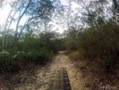
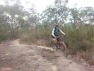
A network of fire trails that spans from Blaxland to Yellow Rock. Great for a short rides. Best for linking the Lower Blue Mountains to create some epic rides.

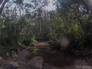
Cause way on Woodford Creek Trail
NB: Originally posted elsewhere on the Global Riders Network and appears via syndication.
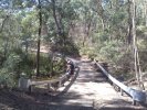
Heading back to the car from the Dam we turned left just before this cause way to take an alternate route towards Wellesley Road/Trail which we had parked our car near the gate on Woodford Ave.
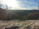
Lake Woodford
NB: Originally posted elsewhere on the Global Riders Network and appears via syndication.
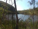
Would love to be able to take a boat out and fish. So beutiful here, Shame thats illegal here.