You are hereForums / By Discipline / Mountain (off road) / By Location / Australia / NSW / Irate Intern (or Angry Doctor) Garmin map anyone?
Irate Intern (or Angry Doctor) Garmin map anyone?

NB: Originally posted elsewhere on the Global Riders Network and appears via syndication.
Hey,
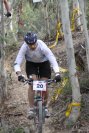
Does anyone have a garmin file to the Irate Intern (from 2009 or before)? Failing that, an Angry Doctor one? Failing that, some guidance on if the loop is signposted etc?
I'm heading down to that region this weekend and would like to know where to ride.
Cheers,
Tate.
- Login to post comments
- Bookmark & share
Tags
Here's my profile from the 50 in 2008. I was going pretty hard so you might struggle to keep up if you're following the profile
Sweet! Nice one. Thanks mate! It looks like its made up of 90% singletrack!
Any other pointers while down there? Is there a MTB club website i should check out first?
At the start, the race goes through Old Mogo Town, or whatever its called now. There may be issues about doing that at other times without permission. Though there is probably an easy way around without missing any sniggle. Same applies to the dam area, though that may be more of an issue about whether the gate is open when you want to go out to cross the highway.
In both halves of the course, there was significant tree downage in the storms that up-stuffed last years race. Months later, many areas had still not been cleared. You might need to check with the Eurobodalla Cycling Club or one of the local bike shops as to what is now cleared before heading off.
Great, thanks guys! Last minute training for the Fling is looking good down south then.
Ill also head into batemans bay cycle to see what they have to say.
Cheers,
Tate.
When I get more of a chance I'll put together something a bit more comprehensive but in a nutshell you can ride a pretty close approximation to the Irate Intern with no major dramas. I have a GPX log I can send you of when I did it mid August if you like.
The first 50km (ie the part up near Batemans Bay) wasn't hit anywhere near as hard as the area to the south of Mogo where the second 50km runs. Not sure what it's like in there now but last Christmas it was still really smashed up.
Basically nothing is signposted (with anything meaningful anyway) so you will need something to help you find your way around.
Drop me an email at t_brown@westnet.com.au if you want the GPX and I can also put together a bit of a map.
This is taken from 2009, 2010 got smashed up and never happened and 2011 also never happened.
Hope this helps?
Tate - I've got a mate down there who rides well, and knows all the trails. I'll flick you an email tomorrow and can hook up with him.
Even better, someone to show me the way!
Great response guys. Appreciate it.
The guided tour will be a much better experience.
Since there is pretty much no signage (other than the club track) it can be bit disjointed trying to find your way around.
It's worth doing a loop of the club track whilst you're down there too (a part of which includes the 'snake track'). Head down Maulbrooks Rd and you can't miss it.
with summer coming up no doubt a few Nobmobbers will be heading down the coast for some R&R in the next few months, so any feedback on the state of the Mogo trails would be welcome, given that there is no Angry Dr etc this year.
Doesn't seem to be much "news" on the Eurobodalla Cycle Club website that I could see....
As of late August the first 50km of the AD course was pretty much fine. A couple of localised ride arounds required. At around the 30km mark I recommend taking Salt Water Road rather than the alternatives as they were severely blocked last time I saw them (normally the AD takes the logging road prior to this).
The club tracks were ok, looked like they werent getting much use. They have a 13ish km loop open. Looks like some of the trails in the middle of the loop might have been re routed rather than trying to repair the damage as they were a bit raw.
Thanks, the full club loop wasn't open last time I was down there and anything else over that side was a mess. No doubt the track will get a bit more use during the summer months.
Tate
Have you got an update on the Angry Doctor tracks from your trip the other weekend ? Condition of existing tracks - new tracks found etc etc.
D