You are hereBlogs / Brian's blog / Oaks Up & Back Profile
Oaks Up & Back Profile

This was the first time I had done the Oaks Up & Back. When we arrived at the first gate (start of single track) on the way up I wasn't feeling the best. I knew it was going to be a hard ride and I wasn't wrong as I was already stuffed. I pushed on and with one stop at the helipad and then to the top. I actually thought the group would have started descending before I made it. I arrived with time to down a Gu stretch and we were off again.
We regrouped at the helipad and then it was off to the gate. Managed 8 minutes 21 seconds with my heart rate averaging 183 and my max 192 I had nothing left.
I must not of being thinking straight by now as I took the option to do the extra Pisgah Ridge and back, then back up to the single track including the techy bit at the end.
By the time the climb out arrived I suffered massive cramps (first ones ever) in both legs. After a short rest I arrived at the car in the worst shape ever.
I’m glad to only be doing the 50 at Mogo 
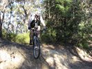
Below is my profile
- Brian's blog
- Login to post comments
- Bookmark & share
Anyone that disses the Oaks up and back as an easy ride is a joker. There is nothing easy about it at all, particularly if you ride it at higher speed and minimal stops. Well done Brian, if you can do this ride then any other 50 km race will be more than manageable.
The Oaks up and back is a great ride and it does get easier once your fitness gets a little better. I think it is becoming my favorite for a quick hard training ride.
I must admit it was a bit surprising to see you coming to Pisgah, but as Ditty has pointed out, if you can do this you will be fine at Mogo. I'm not going to say you will find it easy, but you should finish in a good time.
Pushing yourself (within reason) is a good thing. How nice is it to get home knowing you've given it your all!
I always find it hard to resist the lure of unexplored tracks regardless of how I am feeling.
It was great to see you lot flying past us on the ride down from the hellipad. As Critty said, there's a bunch of guys seriously single tasking! Brilliant
For the record I think we did the same track you did but also pisgah ridge fire trail. Your GPS shows you did pisgah rock trail?
Dylan
We did Pisgah Ridge all the way to the end. The fire trail turns a 90 degree right as you head out where a walking track goes ahead (I've never been down that track straight on). Following the fire trail There's a bit of a gradient then a clearing at the end with some nice views:
Pisgah Rock is only a 700m or so out and back single-ish track that is closer to the gate junction. At the end there's no real clearing although the view is also nice:
OK, I'm confused then. According to your GPS thingy it says you did 6 kays, let my bike computer says we did 71, even though we both seem to have done the same ride. Perhaps you where wheelying a whole stack of it?
Ah... the GPS never lies... mine recorded this:
http://trail.motionbased.com/trail/activity/6521080
You computer needs a bit of calibration, eh?
Also, the edge 305 uses GPS and a rear wheel sensor in case signal drops at all.
Yeah - 30m diff between you and I on this ride is rather impressive. Leo - what did you have?
Perhaps mine does, but both of ours?
Also your map isn't showing the same ride we did, I was checking my GPS at the end of pisgah ridge and it was way more north. It doesn't show you did Pisgah ridge according to this image
that shows you went to the end of Nepean road lookout?
Yeah - that's where we went - Nepean Lookout. My bad - descriptive malfunction
Fixed the MB title.
The brown line on that map - that's the track I've never been down but it's there on the topo. Ahhh... so that's where you went?
Rob, here is my profile for this ride:
http://trail.motionbased.com/trail/activity/6521053
Very similar indeed!
Ahhh yes Rob and navigation.....
I remember a certain Terrey Hills ride where he proclaimed "I know exactly where we are!" Famous last words as we then proceeded to circle our way around the back streets of Terrey Hills.
Rob, you had me worried about MY navigation skills (which are next to non existent without my GPS).
Yeah, we went to the end of Pisgah ridge, really nice on the way down, if a little overgrown. Fast single track similar to the main ST just a lot less used. Ends up in some fun rock garden stuff too. I thought I saw some tracks there, guess they weren't yours.
You guys are hard core to do Cascades the day after.