You are here
Firetrail
Ingar Firetrail
Dead End
Start/Finsh
The Start and Finish for WSMTB Club races.
Shaws Farm Fire Trail
Transgrid Fire Trail
This trail continues South to Emu Heights and Mt Riverview
More in formation on this ride is available here Nepean River.
Rough Route to Blue Gum
From behind the schools outdoor squash court this trail runs down a steep and rocky hill to meet up with Blue Gum Swamp Trail.
Shaws Ridge
Although Google says this is Blue Gum Swamp Trail signs at this location name it Shaws Ridge. That makes a lot more sense as it runs along the ridge.
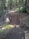
Pretty much your average firetrail - the climb/descent at the North end is pretty steep though.
Springwood Ridge
Runs along the top of Springwood Ridge. Standard undulating fire trail with a really rather nice view on the end known as Grose Mountain Lookout:

Bees Nest Hill
This is a steep firetrail hill. It certainly wasn't smooth when we visited (July '08) and had some large, loose rocks at that time.