You are here
Firetrail
Winbourne Road
Firetrail
This trail appears to run further to NE.
Firetrail South
Kings Tableland Rd
From the highway, you have sealed road down to the hospital. You've already passed the Ingar turnoff if you get to the hospital.
Anderson's turnoff is marked a distance down the road.
Glenraphael Drive - North
No real parking near the Cliff Drive unless you go for the lookout around the corner above.
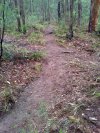
While it's a plain old 4WD trail, it has a steep descent and climb.
Watch for tourist cars going to the gate area.
Glenraphael Drive - South
This section starts from the NPWS locked gate and heads south to a great lookout via two major climbs and descents.
While it's a plain old 4WD trail, each descent, both directions, is steep, loose, drainage across road, wet, slippery and likely to end you up over a cliff at the turning points.
Just the grades on these two points I think gives it the Black Diamond. Almost as steep as my 20year old memory of Bedford Creek.
But if you can get past all that and really, the scenery, it slows you down so much, anyhoo, it's a nice afternoon in good weather.