You are here
Single Track - Exposed
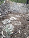
Bathurst XC stage 1
Stage 1 of the XC loop.
There is not much in the way of trees so it's a bit exposed to the weather and any excursion off track is flirting with flats from a tire full of catheads but it is heaps of fun.
Starts up a little hill on wide track then take the second left (arrowed) into the single track. Over the rock roll over and some other artificial obstacles and it's like a mini flow track across the back and down to the bottom.
Back onto wide track and up the the center climb. It's such a deceptive little climb, almost flat but it hurts so much at race pace.
Zig-Zag
Connection
Spiral
Snake trails
A fun bit of trail with some pinches and some flow.
At the time of writing this trail is only just roughed in
Python trail
Clockwise you get a fast Dh with some techi off camber.
Anti clockwise it's nice little climb to open the lungs up
Rags To Rich's
Rags to Rich's.
Clockwise from the train line up to the Bicentennial trail is a tough little climb.
1 or 2 tight corners but mostly wide open stuff. No long climbs some short pinchy stuff and false flat.
Anti clockwise the trail transforms into a fast open, off chamber grinfest
Single Track
Enduro Loop (Middle section)
This is the middle section of the enduro loop
Can be done as a loop on it's own in either direction (I think it flows better clockwise)
or used to get to other stuff further out.
Off roads
The off roads are a bit of a short cut down the back side of Hassans to the Vale road. Loose and rocky in places