You are hereForums / The Knapsack Project / Update on Knapsack reserve post 29Jun10 meeting
Update on Knapsack reserve post 29Jun10 meeting

As a quick update on whats been happening post 29Jun10 ... which I propose we call "Blue Mountains Sustainable trail day" 
Reps have provided a short list of contractors / design experts etc to assist with the creation of trails in Knapsack. BMCC staff will review and engage these contractors amongst others they may chose, as part of a selection process.
We have put up a mix of pros such as World Trail (Glen Jacobs) and Dirtz (builders of the new Mt Annon trail), IMBA ... as well as a collaboration between IMBA / BMORC and WSMTB, which is obviously our preferred option. (reminder to register your interest to the Yarramundee IMBA workshop day ... see BMORC news or talk to JP - the Brown Hornet).
We will leave selection with BMCC staff as in the end we are more then confident in their abilities and the level of engagement that we have had all through this journey to date.
Reps will be meeting on site with staff, on the Saturday 24th for a bit of a scoping exercise both in terms of next actions and potential track locations. I'll open this meeting to those interested ... but it will be more about planning, as opposed to designing or putting shovel to dirt.
Please PM me, Kingy, Mog if you are interested in coming along or post here (I'm not going to put a ride calendar entry for this) ... but, bring your bike .
In the mean time we would also like to start mapping the current trails that proliferate the reserve ... picture GPS mapping with the view of highlighting the trails before we rationalise, versus what we end up building.
And then overlay on top of this our preferred tracks/loop ... and or the final tracks.
OK sound good ??
We will commence mapping next week ... Kingy and I have access to a garmin each ... and if you have one and are also available let me know ... we'll try and post up our mapping each day where possible so that anybody available next day can focus on areas not already covered. I'm not overly familiar with the tracks there so a couple of guided rides would be good.
Post up if your available next week and what days and we'll organise something as we go.
I'm available Tuesday and Wednesday Todd are you available Tuesday ??
Al
- Login to post comments
- Bookmark & share
I will be fine to come next week... preferably Tuesday or Wednesday.
If you were able to come next Wednesday night there are a few of us Lower Mountains guys that ride there each week. I can map on my I Phone and have been riding there since about 1999 so I know the tracks well.
Unfortunately I can't come during the day as I have a normal job but may be able to come on the 24th.
I am available for Fridays no problems!..or half day mondays am!
If you need me let me know!
I wouldn't mind coming along Sat 24th
Almost impossible for me to get away during the week
Vinno ... I'll try and come along Wednesday night ... I also need to talk to you at some stage ... I'll PM soonish
Andy ... cool re 24th.
Todd ... I'll confirm closer to friday ... Mike has mapped quite a bit already so we may be infront and can focus on a "preferred" track/loop.
Im off work mon 26th - fri 30th and I dont work weekends. I also know the tracks rather well. I won't get lost any time soon. I've been dieing to map out Knapsack and set out my loop. I'm close to finalising my prefered loop.
Al,
I should be available on Sat, or midweek ( Mon or Tues )for mapping (Garmin attached) just let me know.
Wed is out.
Cheers
BrianH
I'll PM you Monday night Brian ... planning on being up there Tuesday with a few others
Tim
Just be aware that your loop may not be what we end up with ... but that'll just mean you get to PB a "new" track
Just managing expectations, as whats currently there may not be what we end up with for various reasons including, but not limited to, sustainable trail design, multi-use ... sharing is caring compromises ... trail redirection etc etc.
Soren's email
"On the proposed site meeting on the 24th July can we meet from say 9:30am to 12:30 pm."
Suggested agenda
Track inspection ( we can do this by bike, at least part of it)
Review site constraints ( I will bring some maps)
Draft project brief / Specifications for track/ trail mapping
Discuss preferred process for track / trail planning and design
Discuss preferred process for track / trail constructionCommunity consultation process.
Any other issues?
After we have a project brief and agreed way forward I will follow upwith seeking professional input on the trail design. ..."
I'm locking this in with Soren tonight
Heya, ).
).
I should be around this weekend, so count me in. I reckon I've got a pretty good loop going on (I'm sure we all do eh?
More than happy to get a finalised, formalised loop going! See you on Saturday!
meeting at 12pm @ the sports oval for a bit of a reccy, mapping and photo op.
few of us goling ... so no probs if your working heee heeee
Boo to all of you shift, part-time & lazy-ass mofos


Bloody full time work is ruining all my riding time... Enjoy the ride guys!
Hey dammit, I resemble those comments! I'll drop in for a visit at 12.
Hi Al,
Will try and see if I can get up to Knapsack on Saturday and will see if I can get Matt & Kisma to also come along.
Cheers, Gus
cool dude ... have a look at the IMBA / mundee day too 14th Aug ... be good if you 3 can come along to that too
Where are we meeting tomorrow
And 9.30 is the time?
http://maps.google.com.au/maps?f=d&source=s_d&sa...
9.30am ... bring your bike
Hope to get down there in the morning.
I'll be there...still feeling post-flu effects so will labouring up the back of any riding.
I'm out. Have a good day guys.
good meeting today ... thanks to those that made their way out ... hopefully there was more pedaling after I bailed.
as a very brief summary
i) we need to finish off the mapping.
If anybody is available I'm likely heading up Tuesday ... prolly worth some coordination with the mapping efforts ... I still can't get into openstreet ... bah (I'll PM to organise the effort).
Mike ... if your available I think we should map the rest of the trails early in the week ... with Friday used for the DH track.
Vinno
I may join you for your Wednesday night ride to ride your loop and also discuss what the preferred XC loop looks like ... I reckon the longer the better and we seem to be excluding a bit of land that we could potentially use (presuming it will make the track not just longer by also add to the riding experience) (Mike, Gaby and anybody else that wants to add some input into the XC loop if you can come along then it will make agreeing a track easier).
ii) We need to map the DH track and alternatives
iii) we need to send the data to Staff ... he will also send info on the required format. I'll pass this on to Mike.
we have two weeks to finish our mapping so we can commence the design/ contractor engagement bit.
There are many other actions but these are the current priority (unless I missed something).
Hi Al,
Sorry for the non-attendance today, but my back was not up to walking around the tracks as I hurt it during the week. But I am off work from 3rd August 2010 so am able to follow up on some things if needed. So keep me posted and I will happily help out where I ca. Also let me know when the DH mapping is going to happen please, I think we need to make sure we spend plenty of time getting that right as well as all the other tracks of course.
Cheers,
Gus
Definitely a good day, with lots of positive indications for the future!
I wish I could make it to help out with the mapping, but unfortunately I'll be working all week...
I think early in the week should be DH planning.. maybe Tuesday... that will be the largest effort especially seeing the bottom of the current track is very poor and unsustainable and there seems to be a good possibility for turning it into something good. With the possibilty of needing some new lines to improve sustainability as well as rideability defining these will be very important.
I think Al and Paul and whoever else can come along should attack that. I shoudl be able to do some time on Tuesday.
Al, if you can do a Wednesday night with Vinno ride then Friday the XC can be defined with Michael. The XC is going to be a lot easier than the DH.
Overall a really great meeting... I think there is a real possibilty for creating something really good that suits council and riders and other users.
Al,
Will be able to do Tuesday about 11.00 on if you need some help. Rest of the week should be good to go as well.
Cheers
BrianH
There were some questions about BMCC maps today like Soren had... basically these are online in a dodgy form but all the info is there.. go to
http://www.bmcc.nsw.gov.au/bmccmap/parcel_search...
Knapsack is "31 Great Western Highway, Glenbrook"
When you get to a map you can select different map views which define terrain, environment, ownership etc... worth checking out.
Oh and the tracks that Michael has drawn onto the map
http://www.openstreetmap.org/?lat=-33.7710070610...
I am off all this week if anybody needs me to go anywhere!..or do anything!
Vinnie and others, I have something on on most days this week, including Wednsday, but will be able to do next weekend or Tuesday evening.
Matt
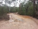
Hector an I "checked out" the old Downhill Track on Sunday. Surprisingly nice trail with plenty of potential, albeit a bit short compared to the length of the shuttle back to the top, better then nothing by heaps though.
Are we pretty much looking at using this trail or building a new one? Also what level of difficulty are we looking at? I mean there are a couple of decent rock gardens/drop offs/step downs that could be beyond some folk. Do we have the option for B-Lines?
Also I'm wondering where the drop off point would be? At the beginning of the fire road? Surely this is going to agitate some of the local residents.
The bottom steep half is where the problem/potential is. With Soren it was agreed the quite long, steep, eroded descent was both unsustainable from council perspective and from a rider perspective its a horrible waste of altitude.
So current plan is to try and look whether there are alternative routings for this section that can be made in a sustainable manner and that don't just waste height. Paul has some good ideas, but its a matter of planning a good line and then passing it through the council hoops. It will have to meet the environmental requirments (there a quite a few in that area), the heritage issues (ie no aboriginal artifacts etc) and whatever other issues they may have to meet.
One does look at it and think its a horrible waste of height... with that much altitude... 100-120m you could with a better routed track get a decent length and time for a track... of course there really isn;t the option to create a whole new track as mentioned above.
BTW how long does it take an average downhill rider to get don it currently? Anyone have a measurement for its length too. (Paul was making the start point sort of up still on the flat one the widish trail that crosses lovers walk after around 150m of riding).
In it's current state I'm guessing about 2 mins or so..
In regards to the DH track, is there an option to create a new track and yes I agree the altitude needs to be used wisely, but surely we can permission to build a decent DH track and perhaps also a challenging XC descending track, similar to Stromlo's berm track.
Creating a fully new track isn't really an option, but conversely as the areas which are definately not sustainable are also the areas which are the steepest, (ie where water erosion is the worst) and therefore the greatest altitude wasters these are the spots where creating a sustainable rerouting becomes essential.... that would lead one to think of some requirment for bermed corners or a way of adding length in some manner that has lower gradient.
Finding a rerouting that meets the requirements of the council restraints and allows for improvement of the track is the tightrope we have to tread. We still have to see what we can get away with a build the relationship of understanding.
As much as the berm track at stromolo (or the I think even better Cressy Climb at YouYangs) I don't think the possibilty to do something like that is an option here... it would have too large an enviornmental impact in a sensitive area. Also we aren't going to get given earth moving equipment to do this work... a chaingang of riders is just not enough manpower.
I think the current plan is to build a relationship with council such that they learn our needs and our attitudes and respect of the environment. From there we can try and turn the trails at Knapsack from having an eroded mesh of bits of track trail and a very dodgy downhill track into a sustainable network of XC loops of various grades and good solid DH track. Is it going to become a place of legends.. I'd say not, but as long as it is a solid riding area that will be good. Further, if it was left to exist in its current manner, the erosion would probably get too excessive and would end up being closed in a few years anyway... much like what is happening at Yellomudee now.
However, there are limits with regards to budget, environmental impact, and common sense.
The old chest nut of why rip up virgin bush when we have well established tracks (all be it not entirely sustainable) literally the other side of the gully. Similarly, the more money we need to burn through the more money we need to find or chip in ... which means time, amongst a lot of other things.
In the end we have been given enough rope to define the track that we want ... but we need to be realistic, apply sustainable trail principles, yet have logical land management considerations as well, else we lose all credibility IMO.
I see this as a cost/benefit thing ... we will mark out a number of alternatives, including the existing DH track ... list the advantages and disadvantages of each one ... and push for what we need. We've all said from the beginning that this was not the ideal location, but we'll work with what we have and I'm confident we'll get the best track possible, or work with council for a better location.
Re: the XC track ... I'm quietly confident Knapsack will be one hell of an XC trail "NETWORK" mapping is well advances and we'll hopefully have details of the loop for peeps to ride and give feedback on very soon.
maybe this thread should be moved to the new Knapsack area ???
Will it be available on Google Earth?
Was out exploring knapsack and there is one section I don't see a decent section for a loop but see a great possibility where there is no trail yet.
I'm looking forward to viewing the mapped area and mapped idea for a loop. I'm rather very excited!
I'm going out there tomorrow with a ute full of Boral pallets and a mattock. Who wants to join me?
JUST KIDDING!!!!!!!!!!!!
Seriously I'm adopting Knapsack, I love it. Ride to the top from Emu Plains carpark, do the loop, hit the downhill all the way back to my car. Sweeeeeet.
Pointless post I know. I thought I'd chuck it in anyway.
Al, Kingy and I spent all day up there today looking at DH track and various variations as well as looking at XC track using feedback from riders for a practical loop.
Hopefully that can get looked at tomorrow and I can get some feedback that any adjustments, plans etc and can the update the map. I will try and then post it up here late Saturday so people can ride it and think about it Sunday.
Will possibly try for a Tuesday final XC mapping plan session that we can then present to council.
Personally I think Knapsack is currently quite good, but it is still a disjointed bushtrack that prevents a sense of flow and journey... it is a series of really interesting sections joined by some rather forgettable connecting track. Sadly some of its charms are the eroded sections that will either have to be realigned (ie switchbacks and stuff) put around them or get some serious rock armouring... hopefully this can keep them interesting, make them more flowy and make them sustainable for council.
This site has greater potential than we may all have ever realised, we need paitience and co-operation from every one, Moggio, Nerf and I are on the job, give us some space and we will produce results.
What we need now is a solid commitment from riders who will be there to rehabilitate OBR and Nichols. These works will commence soon and will be a catylst for being demonstrative as a group in what we can acheive with respect to fulfilling our prior commitment in regenerating areas of bush that have been affected by poorly aligned trails on the eastern escarpment, Al has been liasing with Penrith Council to complete some brush matting works at the base of the Nichols track, when the call for volunteers goes out we need you to put your hand up and attend the work day.
These days are part of the documented labour component of our agreement and will validate the financial commitment of man hours that we pledged in order to get Knapsack on the board. I believe that any downhill riders that wish to be part of the Knapsack Downhill project need to be attendees at the sediment control work shop at Yellowmundee on the 14 August, if you have not registered than please be quick about it this will be your opportunity to gain a level of accreditation that will ultimately see you being able to work in direct partnership with Blue Mountains City Council on Knapsack mountain bike trails.
This is a call to arms so if you are registered and have only been lurking on this site now is time to get involved, more news on things soon, we will going out again this week to revisit some areas of the dowhill track so if you are interested to be involved please PM Al with your availabilities Cheers