You are hereForums / The Knapsack Project / Exisitng Knapsack trails
Exisitng Knapsack trails

I would have added this to the other section but was unable to affix an image to the existing thread.
So...
Here are most of the existing knapsack trails. I will have missed a few but not many. It is not GPS accurate, but pretty close. The area around 22 is a bit mucked up as is 25. The area that I would like to see a ridgetop ride on is marked with a zig zag, and in my view would be more likely to be approved than around the military base.
A couple more points on my preference for a network rather than a loop. With the network, you can go for rides with very different characteristics in one reasonably small area. The ads much to the value of it, with the network providing options for a much wider variety of riders than the loop. I have taken first time beginners there, initially around the fire trails, then the easy singletracks, then the more moderate climbs and descents. This option would at best be diminished with a loop, particularly a one way loop. I recently took a pair of skilled tandem riders there. They could manage some of the quite technical sections, but not the tight tunrs (for obvious reasons) so the trail that we took was chosen accordingly. I know teh area well, and on some days I want to cruie an easier option, and others to the hard pinch climbs. Again, the ability to do this would be reduced with a loop.
Yellowmundie is a network, albeit over a much bigger area than here. I don't see why we should agree to, a loop here unless there is no other option. If I was to choose a loop it would be 1,2,3,4,5,7,9 then a u turn back towards 6, the 10,11,12,13,14,15,16,17,18,19,20, 21,22,23,24,21,22,25,26,32,29,28,30,31 33,35,1. Thsi missed some very good sections like 14,17, and also 10, 36 and others.
However, I do agree that some trails need to be removed, and probably some new ones built. Unfortunately some of the best trails will be a difficult ask for environmental reasons (eg from 6-10-36 on this diagram.)

- Login to post comments
- Bookmark & share
Thanks Matt for the details... I apologise for not answering sooner but I have been in and still am in a feverish state and are feeling very dodgy.
Is the bridge at 26 a worthwhile addition.. I have heard yes from some and no from others. I will list it in the report because I guess we may as well.
Yeah trails like 14 and 17 (well the ones to the east of the 15 16 ones) are the type of ones that I imagine council will want to close off because they are in such bad condition.. however closing things off may result in abitility to open new stuff.
WRT ridgetop ride, the bit that is sort of around 28 has been strangely brushmatted by council, yet they have left a single track open there when closing the fire trail. So there is probably a reasonable opportunity there. The 22 23 area, I feel will be harder to convince and build but will list the suggestion. The area going east of 23 seems to have a partially done ridgetop ride as well that is quite good, that doesn't go anywhere at the moment.
As far as "netwrok" idea, I guess everyone realises I strongly diagree with the idea by now, but will put it in the report as the prefered approach by riders.
Wow, looking at this map I can see a whole lot of trails that I have never bothered to ride and i have been riding here since 92' i guess being a xc racer from way back i was always more about doing the established loop that scurts the back of the soccer fields then hits the two gullys and brings you to the first look out and then the link track to the next lookout and then around via the quarry up the rock face track and then back around via the link to the soccer fields.
My thoughts are grab what you can, but the last thing I woukld like to see is us as BMORC going in with a map that shows everysingle last trail as some sort of exhaustive exercise in the hope of getting some of it across the line and being satisfied with that.
My intitial thoughts were in support of a network, but I envisigaged just a couple of broad loops that met between ridges, some othe maps i have seen since the proces started are really starting to go to the extreme and to this end i have had a rethink on my position.
We need to show a bit of leadership and commonmsense here, we all know that some of the tracks inside this reserve are not sustainable, I don't care how much fun they are too ride, if it means that we have to maintain them then I want to make sure that they are easily maintained.
Once word gets out we have these trails going we are going to see an influx of riders and I from my experience on Old Bathurst Rd can tell you right now the majority that travel to Knapsack wont be coming there to do trail restoration or maintence, so before we open the flood gates on all the "network" let us take a moment to think about how we are going to manage the trails that we were going to take on, there will be many hours of off the bike yakka involved and in my mind a suitable loop that will keep me fit and be a win for length and diversity that takes in the majority of the site will win over a network that criss crosses all over the place and which will utimately mean extra maintenance down the road.
So to that end I say just because it exists does not mean it should be kept.
We know that the council and IMBA are going to be thinking aloing the same lines so why not aline our thoughts with theirs early on and make this process as easy as possible, I really don't want to compromise this whole process for the sake fo a few side tracks here and there that may untlimately hinder the cause.
Our group was formed and based around sustainability so lets make decisons based purely on that, if the local flora and fauna can not tolerate a network and we need to ride less of what is there to gain more than so be it.
My thoughts may not reflect the majority but I am begininng to understand how things work in council and with environamental groups, tread lightly!
Hi folks,
I am relatively new to the area but have been enjoying the Knapsack trails since February this year. I moved from Hobart which has been having troubles getting trails authorised for MTB riding and the problems seem much the same for BMORC.
Kingy, I agree with the concept of simply choosing the best tracks that can be used to create a loop/s, such as a really short easier loop and a longer loop with more entertaining trails. The trails that cross the gullies will require the most intensive work to make them sustainable but without these steeper trails I suggest that the reserve is likely to appeal to less riders. It is true that many of the trails in the reserve have sections of trail that by the IMBA design criteria are simply too steep and unsustainable. Leadership is required to decide the battles worth fighting and the trails that deserve the time and effort to make them sustainable.
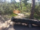
That said and I am enthusiastic to see some of the steep trails developed. For instance, I personally feel it'd be worthwhile to try and keep trail 36 below the old Glenbrook STP with the bridge and that this trail would allow the formation of a longer loop if BMCC were willing to promote a track through the mushroom farm. The track has a great feel, takes riders through a different environment and gives a sense of journey. This track most certainly requires extensive rock armouring on the steep chute into the gully, realignment of the short and steep section out of the gully on the highway/RAF base end of the trail. I offer these suggestions as someone who has built trails elsewhere and is aware of the effort required and will patiently wait until I can pick up some tools to help BMORC.
Late last week I noticed someone had started building a new trail behind the RAF base from the zig zag track towards Knapsack bridge and felt the need to inform BMCC of the new trail being build. I was excited to find the new work on the old trail between the RAF base and zig zag but the creation of a new track from Zig zag down can only be bad news for all mtbers in the area.
Cheerio
I am firmly in the belief that the best way forward at Knapsack is to get a perimeter loop established also taking in what ever established trails are in linking the outer loops.
Track rationalisation will be at the behest of the IMBA and Council findings, there are many areas with in the circuit that require a lot of man hours and materials to make them viable, some of these will be key in the creation of effective links between the outlying sections that would other wise just be isolated peices of trail.
Our main push should be for getting something simple to start with and accepting that, with the proviso that in time once the trails are being maintained that we will be able to explore further opportunities with in the reserve.
I see this as being a proactive way of building a positive relationship with council and limiting the potential for the site becoming oversubscribed with non builders whislt the trail works are in progress.
I am adamant that if we grab for every bit of trail we can lay our hands on then we will be biting off more than we can chew, as this forum and the collective individuals of which is compromised largely dictate what happens in the long run i can only put forward an opinion and allow the group to advocate for waht they think is best.
Bottom line though, I live pretty close to the site and will have avested interest in making sure that the trail maintenance is being kept up, if lessons from past trails are anything to go by, I will be on the tools more than people who are a bit further away and this plays in my mind when trying to have a huge network to maintain.
Kingy
Lads,
Might it be useful to get together and discuss a preferred option? I' be happy to make my place available (I live in Blaxland.) I think that we are more likely to reach a consensus by talking rather then typing. Friday or Saturday evening would be OK for me.
Cheers,
Matt.
PS I'll supply the beers, so long as you drink coopers
Friday night would be good, I would fall asleep Saturday after the trail workshop at Yarra, but i think it will be a case of the horse has bolted by then as the submission needs to go in by Thursday morning.
I'd like to finish our input ASAP to allow Staff an opportunity to review, prior to giving it to IMBA and the planned site visit. This coming Monday.
However, as I've mentioned previously, there is still plenty of discussion to go through.
At this stage, we are going for gold ... asking for a network, which too me currently consists of an inner and outter loop ... with some squiggles in the middle of the inner loop. Similarly, the outter loop is not likely a complete loop at present. There will be no mention of a uni-directional path, as we want to be able to ride both ways
Current mapping is indicative only, and BMORC suggests both trail expansion and rationalisation to increase trail flow, to incorporate trail sustainability principles, and reduce future maintenance requirements as practical.
Given time constraints in providing assessment reports to council by Oct2010, I'd suggest we leave final trail design to Staff, BMORC and or appointed contractors, as managed by staff in their day to day responsibilities.[1]
There is potential for further expansion of the trail network outside of Knapsack, utilising existing trail corridors, and potential new trails (again with the view of increasing trail flow and or implementing sustainable trail design principles). This can be discussed as part of potential future phases, once the proof of concept at knapsack has been bedded in and assessed by Council and Staff.
Note: The above is in my words and may or may not be tabled to staff as part of Mog's mapping. However, this is where my head is currently at.
Apologies, I can't make Friday evening ... however, happy to discuss on Saturday as part of the Workshop, or on Friday during our tour of mundee.
*edit ... can make Friday = Can't make Friday ... soz
[1] important consideration
Report is sent in... it is really just a guide meeting what council required of us in the last meeting when they made the decision. They can throw it in the trash or use it as a starting point... we don't know. Hopefully it puts us in a stronger position for guiding any decisions as we have already thought a lot of possible solutions out and makes us seem professional and know what we are talking about.
Will what is tabled in the report be what we see at Knapsack in 12 months... I'd say better chance to see a Yowie there. However the next stage is bound to be interesting and hopefully fruitfull.
I will put it up on the website when I get a chance for other to look at and either like or dislike.
Hi,
I'll see you out at the IMBA workshop tomorrow morning, unfortunately an injury will mean that I won't ride tomorrow afternoon. I'll wear a blue NZo BikeWars t-shirt and I guess a Ground effects jumper to make myself identifiable if anyone wants to chat (as I won't know anyone).
My post earlier in the week was on the back of the excitement of finding the trail beneath the old STP with the bridge and on the second time along it I decided that it could be made sustainable. I'd also like to offer an small apology for lobbing my opinions in on this topic when I haven't contributed to the current process in the slightest.
Cheerio
Tim
Its looking like a loop will be the preferred option ... as it provides opportunity to close tracks ( a definite aim) ... in exchange for potential trail extension (with the view of realigning for sustainability considerations).. I refer to "Potential" as all new cuttings are subject to various assessments needing to be undertaken (primarily archaeological in nature but also elements of environmental consideration). Note: trail closures will obviously impact walkers, as many of the proposed closures are used by walkers as well ... so this is a consideration that staff need to make.
Note: archaeological assessment was also something covered for yellomundee ... so likely a new regime for land managers.
The good news is that the Cave / creek trail seems to be OK ... with some realignment (away from the creek bed at the current junction point / crossing.
I believe the outter loop (sewerage / RAAF) is also something we should pursue ... along with higher level recommendations re mushrooms ... and the other side of Mitchell's pass (my personal views to be agreed). All of which is subject to relevant assessment processes.
So .. we need more mapping ... ever little rabbit trail is potentially something we can close in exchange for track extension on the main loop ... there is also scope for narrowing of the fire trail sections (aside from the main walkers tracks) to bring it back to sniggle.
I need to clarify next steps with Soren.