You are hereForums / General Discussion / BMORC Chat / Blue Mountains - Top to bottom
Blue Mountains - Top to bottom

Hey all,
Was discussing this with Andy Bloot the other day and we thought would be good to ask around. Looking for tips on an offroad trail ride that would take you from Katoomba all the way to Lapstone or Emu plains.
Obviously most will say Andos and Oaks, but would like to know I there are any other routes?
Cheers
- Login to post comments
- Bookmark & share
Tags
Hi Gilbo,
Is Bruce's walk strictly for walkers only? Maybe someone on here will know. That's the north side option for Katoomba to Lawson anyway. There's also a lot of tracks on the north side of Woodford (powerline stuff) but then you've got the dam in the way.
Myself and steve humphries have brought up the idea of a signposted route from Lithgow to Emu plains with BMCC several times. Each time the idea has been greeted with "That would be great...No funding this year though..."
Moggio got excited about it and start planning route too...
There is a bit of a shin dig being planned for the centenary of the highway crossing the Mountains and we plan to raise it again there with the organisers as maybe something to mark the occasion.
Anyhoo. If you want to start at the top why not go all the way To Mt Vic. The biggest stumbling blocks are in between Blackheath and Wennyfalls where getting off the tar usually means entering either restricted catchment zone or State rail easements both of which are technically no goes, though gaining permission shouldn't be hard.
AFAIK Bruces walk is walker only and the original route is interrupted by the dam too
Yeah when I was looking at this the Mt Vic to Medlow was the legal rail trail.. medlow to Katoomba was a mix of old trails and some asphalt. Then Katoomba to leura was ashpalt, some single track and fire road through Leura to Wentworth falls then asphalt to start of Ingar, Oaks, then some asphalt over to Knapsack and down either the current DH or the other "DH" track which is the old eroded fire trail.. or some variation of fire trail and Mitchell's Pass. I think it was like 70% dirt of some form at best and that was all legal.
There are those trails like Bruce's walk and another link to Wentworth Falls from Mt Hay rd etc etc. north of the highway side but lots of restricted land or either just too much hike a bike going down some huge gullies... not really rideable.
Below Lawson I don't think there are any continuous sections of trails that run on the north side in a continuous manner that could be linked up
If we could get permission from council one day to push for this and get permissions from RTA, RailCorp and SCA you could probably easily cut some nice single track in places and use rail trails but its a big ask with a lot of different agencies. I also think the plan for council is more likely to lean towards a paved connection rather than something linked for mtbers.
Did you say Ingar, i never want to hear that word again!!!
What's wrong with Ingar Todd? Haven't you got one of those special 40 tooth cassettes?
Ingar Ingar Ingar!!!!
You had a bad day that day didn't you!! That was riding up it though... damn that was a boring ride. I think you mysteriously flat-lining was the most interesting bit of that section of the ride.
This would be riding down it, so 13km or whatever going basically down a boring down slope, before the awful climb out of Bedford creek. Would all be over relatively quickly.
Yeah - have to agree, it's as boring as batshit!
That was a bad day, i hated every inch of that 13km of fire trail, mentally i didnt want to do it, i think in reverse would be awful as well, that day was hot and the constant grind of climbing and no shade.....i had a dose of the shits real bad by the end!..much prefer the grinding climbs of Mt Hay anyday!
Last time I was there it was stinking hot. Definitely a ride from hell.
I know there would be a bastard of a hike down into Wentworth Creek and up the other side, but has anyone been right to the end of either of these roads and have any feedback on how much of a mission it would really be?
Do you mean the bit between Mt Hay Rd and Nth Wentworth Falls. I think Andy said he had looked down there and it was a crappy walk and definately not rideable. Though I may be quoting him wrong.
I know people who "ridden" the Bruces Walk between Nth leura and Mt Hay Rd and have described it as annoying and pointless to carry your bike all that way.
I think these ways could be used if one really wanted to, but are really not worth excessive effort just to make the point of going by dirt. Even in fantasy land if you could get permission to build any trail you could conceive they aren't condusive to mtb trails. Way too steep and deep.
Without a bike they would link up into a nice long walk however.
Just need to get someone to rebuild the Engineer's Track as it was called. Richmond to the Darling Causeway via Grose Valley. Nothing resembling rideable these days....
No I'm talking about riding right to the very, very end of My Hay Rd. Instead of stopping at the car park where the Butterbox Canyon walking track starts, take the right turn and keep going on the fire rd all the way to the end. I haven't done it, but it looks like you should end up here:
-33.64122290071321, 150.45022130012512
Then on the other side of the creek, it looks like Queens Rd (actually Binnowee Drive) finishes up here:
-33.650440232750285, 150.46828866004944
Again, I haven't checked this all out, so I might be speculating out my posterior. But if the bash down and over Wentworth Creek was doable, the link-up might be an interesting adventure.
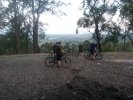
I did that with Mark on a cold windswept dat, great panorama lookout!
I've ridden a long way down that road the Hurley Heights fire trail with Tim... it looks all like this for around 4 kms
the end of the fire road looks like this
where it becomes double track.. this is still probably around 1.5km from the end of the ridge.
That valley looks around 260m deep on google earth, I suspect its one of those impassible ones. Could go out and have a look one day as I enjoy Mt Hay Rd every so often for the vibe and views.
Then on the otherside does the fire trail get close to there or is that just really unpassible stuff?
If there was a reasonable hike across there that would be good.
I remember reading in one of my old bushwalking books of a trail that meets up with the end of the Hurley Heights fire trail but I think that was a long walk from somewhere on the Bells Line of Road. I will see whether I can find the book (most are still in boxes)
Todd we never went down this fire trail... we looked at it though and went "nah!" Its kind of fun-ish as it points down and you can go fast down it but it is a dull slog back up.
Glad to see I wasnt the only rider who has pondered the possibility of full off road down the mountain.
I was on the train the other day and got a good look out the left hand side (north) as it was going down and can see the only real link up would be via the rail service corrider which runs alongside the tracks. Google earth shows most trails ending on the top of ridge lines or just dissappearing altogether!
Thanks all for your ideas and feedback, this will be work in progress
I liked your top speed on your garmin profile 200+kph