You are hereBlogs / Ian_A's blog / Centenary Trail - Canberra
Centenary Trail - Canberra

Hi all,
I thought I'd give a quick write up about the Centenary Trail around Canberra for those thinking about riding it.
From what I'd read, the Centenary Trail was opened late last year, it was a 135km loop around Canberra giving views of the layout of town from different vantage points.
It is recommended that the course be ridden over 3 days, averaging about 45km per day or hiked over 6 days. Of course I thought it was a good idea to attempt the whole course in one day.....
I searched for a GPS trace of the course to upload to my Garmin, but struggled to find one. I did eventually get one that someone had posted on Garmin Connect - I have no idea how accurate it was. I looked up the maps online and took heart with the description of all the course markers along the way.
I decided to start at the War Memorial as it was fairly close to where we were staying. I found the course and set off. The start of the track was exactly what I expected the whole trail to be - mainly fireroad. There were clear markers at this point with the colourful little road thingo and arrows showing where to go.
The course went around Mt Ainslie, Mt Majura and through the back of Majura Pines. It then crossed the Federal Hwy and went through some nature reserve, which seemed like reclaimed farm land. The track had been mostly fireroad to this stage.
Then the single track started - there was surprisingly a lot of it and it was quite good. The descents especially were flowy and well made. Most of the single track was newly made and cut through farm land but there were awesome views to be had. There was a huge flowy descent coming into Hall that was one of the highlights for me.
I came into the township of Hall at around the 45km mark - so far the trail signage had been great. I followed the trail signs through Hall, then they simply disappeared - there were literally no signs in the urban areas......
Luckily, I had the course uploaded to my Garmin but it kept trying to direct me to roads, not the course which followed bike paths and fireroads. This kept sending my Garmin crazy and it turned itself of a few times.
I picked up the trail again around Bruce Ridge, then managed to get lost through the AIS. Next climb was around Black Mountain - where Telstra Tower sits atop. From Black Mountain the track went on through the cork plantation and to the national arboretum - again all signage disappeared here. This was at about the 80km point and I decided to stop at the Village centre on top of the hill for a pie and lemonade.
The next section of track was not very exciting - sandy fireroad through a big construction zone. The only view was the cyclone fencing running parallel to the track. Here, someone had actually removed the arrows off the signs - luckily the GPS proved useful again. The trail headed out toward Stromlo, then turned south and skirted the outer suburbs through bushland.
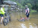
The next section of track headed along Kambah Pool rd - there is actually some pretty nice flowy single track carved parallel to the road and it is flat or down hill most of the way. The single track running parallel to the Murrumbidgee River was probably the highlight for me - it was getting tough with over 100km in the legs already but the views were fantastic.
The next section was again plagued with no signage in the urban area. I followed the GPS trace and eventually came into a reserve where the signs magically appeared again. There was some nice single track leading toward Long Gully rd but after this it was mainly fireroad at the bottom of hills.
Once I crossed Hindmarsh drive, at around 135km the signage again disappeared and my GPS was playing up. I was starting to tire and just wanted to finish - out came the phone and the navigation was set to take me back to our hotel.
I ended up riding 151km with around 2300m climbing in around 7hr 50min ride time and just over 9hr total time. Unfortunately my new Garmin was playing up and the data was corrupted - I managed to get most of the trace but HR, cadence, time and elevation are all out of wack. http://app.strava.com/activities/104819869
Pro's of the ride;
- There was heaps of awesome single track throughout the ride.
- The distance was pretty tough but completed by an average mountain bike rider on a 29er dually.
- The signage out in the bush was fantastic.
- The views of Canberra and surrounds were great.
Con's of the ride;
- The signage once you get into urban areas was completely non-existent.
- There are no trail maps anywhere on the ride to give you an indication of where you will be going.
I'm glad I did the ride but probably will just ride Stromlo, Kowen, Sparrow etc. in the future.
Cheers,
Ian
- Ian_A's blog
- Login to post comments
- Bookmark & share
I totally missed on Strava that you had done that ride. I thought it odd you saying that it was tough backing up to ride Kowen the next day, that doesn't sound like Ian..
That's a great informative write up but a real shame that you had to rely on a GPS trace and finally your phone to finish up. I was looking to do this on my next trip to Canberra, after reading about it's completion I thought it would be pretty easy to follow.
We did the same but as we started late we didn't have time for the full loop. Like you said, the signs off the trails are non existent and we wasted a lot of time in the urban areas looks for the next bit of trail
http://app.strava.com/activities/101185710
It's quite frustrating isn't it Brian.
I see you did most of the good stuff anyway - the ride toward Kambah Pools and along the Murrumbidgee River was fantastic though and one section I would highly recommend.
If they're not going to sign it properly, then at least provide an accurate map, a few maps along the trail and a GPS trace.
Still a nice ride.
I laughed when you said you got lost at the AIS. We were follow a GPS trace and we rode past the front when it then says off course. I said to Wayne, "its telling us we need to go into it". We rode in but you couldn't get through. went through a carpark at the side, around the back, through a gate and picked up the trail. It took us a while to work it out though
I actually carried my bike up a set of stairs and rode down a ramp to near the hockey fields in the AIS.