You are here
council

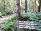
Lower mountains eastern escarpment trails
Hi,
I am a year 11 student currently doing a research project for geography. It involves picking an issue in your local area and researching it and providing the results in the form of a 10 minute presentation.
I have chosen to do mine on the Blue Mountains eastern escarpment bike trails as it interests me and i have seen the issue reported numerous times in the local paper.
I was wondering if anyone has any information, links, contacts ect. That would be able to help me with this work.
Any information would be greatly appreciated.
Thanks.

Council to vote on Knapsack Reserve Bike Plan

The long awaited council vote is less than a week away.
This will be the fate of the Knapsack Reserve Bike plan. (Cross Country and Downhill)
For more information on the Council meeting and Bike plan, the council Business paper can be downloaded from here. Refer to Item 9 (Page 78)
Click here for date and time information

Snap Send Resolve Smart Phone App
Thought this was a really fantastic app worth mentioning
What is Snap Send Solve?
Snap Send Solve is a free iPhone app that lets you report issues and provide feedback to your local council in under 30 seconds Australia wide.
How Snap Send Solve Works
Snap Send Solve determines your council using your iPhone's GPS location.
Once your GPS location has been determined the server sends back all relevant council details, including contact information, location, and email contact.
Correcting misconception and false truth
- BMORC supported the council paper that went to council 16/03/2010 which recommended the closure and rehabilitation of Nichols Parade downhill trail. This is in the council records.
- BMORC supported the formalisation of Old Bathurst Road trails to a sustainable internationally recognised standard
- It is not illegal to ride on a track located on council land unless sign posted otherwise by council.

Warrimoo DH - Needs your support
Keep your eyes on this one guys as it has great significance to the local MTB scene!
http://www.rotorburn.com/forums/showthread.php?2...
Hey guys,
As you would be aware, Ku-ring-gai Council has recently put some signs up the top of the trail implying that it is an approved bike track. This is however not entirely the case. It was apparently too well built, to justify the cost of destroying it so they put the signs in as a temporary measure.