You are here
The Knapsack Project

Bushwalk with my new Garmin
Went for a bushwalk and decided to explore and record some trails I had found on previous rides but never explored. May be of use in the future if everything goes well. (Would like to note that I believe these trails I walked minus OBR where walker made) The track from Survayor Abbot Dr to Mitchels Pass is an erotion nightmare. Like wise was the track from Mitchels Pass up to Maraket Ave is ill desired, One spot I had to climb a rock wall on the track. The walking trail around the back of the properties was in fantastic condition, some spots less ideal requiring a hike a bike.
STP?
Anyone know what is happening at the STP?
If this land was useable to us (and I may be dreaming), I think it would make a great location for a small 4x track/dirt jumps (would require alot of fill to build it back up against the sandstone wall) and a great place for a skills park. No enviromental restraint. A trade off could be the removal of the crazy camals on the other side of the reserve and regenration of that entire area(not just the camels) as it is disgusting to look at! Safer jumps would be better.

Update 6/9/10
All
As you may know BMORC have issued a new report outlining various options for both the primary and secondary XC loops and the preferred DH line with options.
We have outlined pros and cons for all options and preferences, including the preference to continue supporting past BMCC Staff recommendations with regards to Old Bathurst Road.
I recommend you take time to read the report.
http://bmorc.com/node/16874

Updated Knapsack Report sent to Council 3/9/2010
For those interested the previous report has been updated and resubmitted to BMCC after onsite vistis with council and IMBA and also after getting further feeback from council as well.
There are a few changes, nothing drastic, but enough to make things interesting for another read.

Update Knapsack DH tracks
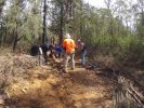
Brian H and I went for a wander down the mountain today in ana attempt to find a new alignment based on the original downhill tracks that currently exist on the mountain.
The proposal we put forward which included a new section of track seems to be a bit of a tough one for the council so they asked for another option based around some of the existing tracks.
So armed with the trusty Garmin device we delved into the potential of what could be created down the hill based around what was there to start with.
Knapsack "Stringline" Downhill track
Hi Everyone,
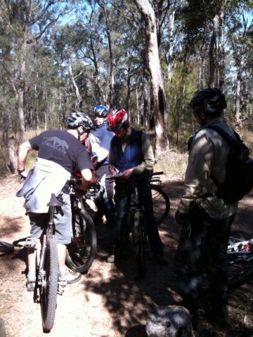
After the Monday out at Knapsack with Soren Mortenson and Nick Bowman we have reached a point with the Downhill tracks where we need to reach for a plan C.
The A plan was use the old track to a point the create a new more sustainable line, the B plan was use the old track with some heavy maintenance, which brings us to plan C.
Knapsack Report sent to Council by BMORC 11 August 2010
If anyone is interested the final reported created by BMORC and sent to council yesterday it is archived in the BMORC Handbook area here
I am currently putting up the council papers that led to the closure of OBR and the possibilites of Knapsack. More will be put up for those who are interested.

Exisitng Knapsack trails
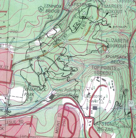
I would have added this to the other section but was unable to affix an image to the existing thread.
So...
Here are most of the existing knapsack trails. I will have missed a few but not many. It is not GPS accurate, but pretty close. The area around 22 is a bit mucked up as is 25. The area that I would like to see a ridgetop ride on is marked with a zig zag, and in my view would be more likely to be approved than around the military base.
Map recommendation as per 4/8/2010

This is the preliminary map that has been created by rider input and lots of on the ground assessment. Some information behind the thinking...
1) We have a limited area to work in and likely limited amount of changes we can do so it is an attempt to best utilise what is there to get a maximum length that can be made entirely sustainable. Primary loop would be around 6.1km.


IMBA to conduct Knapsack site visit 16Aug2010
Our BMCC Staff contact has advised that he has arranged for IMBA director Nicholas Bowman to conduct a preliminary site visit as part of potential engagement for design consideration of either or both the XC network and DH track @ Knapsack.
As Nic will be in Sydney as part of the WSMTB/NPWS soil erosion workshop on the 14Aug10, He agreed to a site visit.